The intelligence behind the number.
The process
From raw data to a single score.
Every score follows the same rigorous pipeline — no shortcuts, no black boxes.
Collect
We pull live data from 25+ authoritative sources — government registries, real transaction records, 3D building models, environmental monitoring stations, EU satellite climatology, and proprietary market feeds most platforms don't have access to.
Analyze
Each property is evaluated across 90+ factors organized into five dimensions. Every factor runs through a calibrated scoring curve tuned to Dutch market conditions, weighted by its relevance and data reliability.
Score
Factors are weighted, aggregated per dimension, then combined into a composite 0–100 score — adjusted for data quality so you always know how much evidence backs the number.
The five dimensions
What the score actually measures.
Each dimension captures a distinct aspect of property quality that traditional valuations miss. Together, they form a picture no single data source can provide.
Valuation
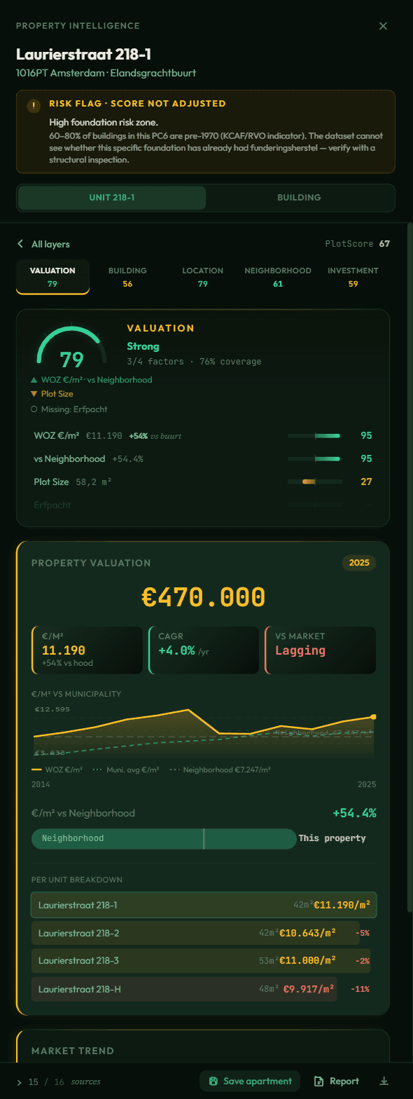
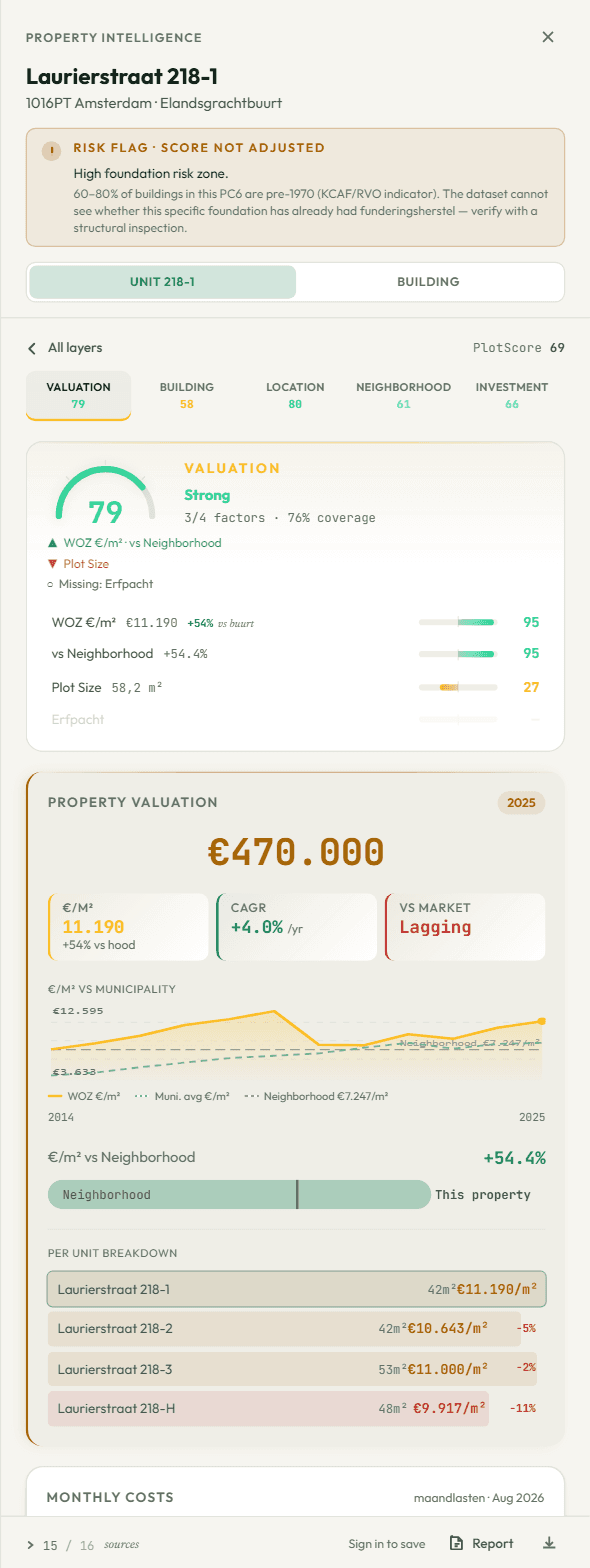
8+ factors incl. transaction dataHow the property's assessed value compares to real transaction prices in the area, its price trajectory over time, and whether the market data supports the current valuation — cross-referenced against actual sales records most platforms don't surface.
WOZ assessments lag the market by 12–18 months. By layering in real transaction prices per m², comparable sales within the postcode, and municipality-level market trends, we catch what static valuations miss.
Representative factors
Data quality
Honest about what we don't know.
Not every property has every data point. An apartment in central Amsterdam has deep WOZ history, energy labels, transit data, and detailed crime statistics. A rural plot may only have basic cadastral information.
When data is sparse, PlotScore pulls the score toward neutral rather than making bold claims on limited evidence. A property with 85% data coverage gets scored almost entirely on its merits. One with 35% coverage sees its score adjusted closer to the midpoint — we'd rather be honest than overconfident.
Every PlotScore report shows a confidence percentage alongside the composite score, so you always know how much data backs the number.
Data-rich property
Data-sparse property
Hard caps
Some risks can't be averaged away.
When PlotScore has direct per-plot evidence of a critical risk — or when the hazard is so severe that no realistic asset-level remediation can be assumed — the composite is hard-capped regardless of how the property performs elsewhere.
Very high flood risk
A flood model showing more than 1 m of water at the plot caps the score at 55 — at that depth, plot-level mitigation cannot offset the hazard. Today's flood source, Rijkswaterstaat's flood-probability map (LIWO), publishes no depth, so this cap is not currently reached; its highest class is flagged instead (below).
Soil contamination
Confirmed soil contamination via Bodemloket or WKPB restriction records caps at 50. These are per-plot legal registrations with statutory disclosure obligations.
Severe seismic risk (Groningen)
Plot within ~5 km of the historic Loppersum epicentre cluster caps at 55. Reflects documented damage-claim exposure and the well-established sale-price discount inside the inner band.
Risk flags
Indicative risks we flag without adjusting the score.
Some risks ride on zone-level datasets that can't see whether this specific plot has already been remediated — a pre-1970 canal house may have had funderingsherstel done in 1985, a near-epicentre property may have had NCG versterking applied. We surface these as amber flags so you can verify on-site, but we don't clamp the composite on indirect evidence.
Foundation risk zone
Pre-1970 building in a KCAF/RVO indicative pile-rot zone (≥60% pre-1970 buildings in this PC6). The dataset cannot see whether funderingsherstel has already been done — verify with a structural inspection.
High flood risk (about once every 10 years)
The highest class on Rijkswaterstaat's flood-probability map (LIWO): flooding from the sea, a lake or a major river about once every 10 years. Property-level mitigation (raised floors, internal barriers, sump pumps) exists but isn't captured in the national model.
High seismic risk (5–10 km Loppersum)
Plot in the outer Groningen band. NCG versterking status is tracked per-address and isn't publicly visible — verify whether structural reinforcement has been applied.
Market intelligence
Real transaction data, not estimates.
Every valuation score is grounded in actual sale prices from the same postcode area. We cross-reference recent comparable transactions to validate WOZ assessments against what properties actually sell for — the kind of data brokers usually keep behind closed doors.
Comparable transactions
Recent sales within the postcode matched by property type, floor area, and construction era.
Price per m² benchmark
How a property's assessed value stacks up against actual transaction prices in the area.
Market trend signals
Municipality-level price indices, year-over-year momentum, and compound growth rates from real sales data.
See it yourself
90+ factors. One click.
Click any building on the map and watch the score assemble in real time — every factor, every data source, every insight that normally takes weeks of due diligence.
Sign up